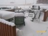
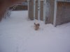
A deep low pressure system currently in southern Saskatchewan continues to track northwards and then westwards towards east central Alberta. This low pressure system will wrap warm moist air aloft into north and central regions of Alberta producing heavy snow overnight into Monday. Many areas will see at least 10 to 20 centimetres by Monday afternoon with the Lloydminster and cold lakes regions having the potential to see local amounts of 20 to 30 centimetres by late Monday. In addition strong northerly winds associated with this system will continue to generate blizzard conditions in Lloydminster and Cold Lake regions today into Monday. Heavy drifting and reduced visibility due to blowing snow will continue through Monday over most of north and central Alberta including the city of Edmonton.
This site uses cookies to help personalise content, tailor your experience and to keep you logged in if you register.
By continuing to use this site, you are consenting to our use of cookies.